Transform Your Community Engagement Process
Pricing Plans
Monthly
$30/month
Perfect for short-term projects and consultants needing flexible engagement tools.
Includes two week free trial. Cancel anytime.
Annual
$300/year
Ideal for municipalities and agencies running long-term community engagement initiatives.
Includes two week free trial. Cancel anytime.
Frequently Asked Questions
Effective community engagement is crucial for successful urban planning and development. It helps reduce project delays and opposition by ensuring community needs are understood early, leads to better-designed spaces that truly serve their communities, and helps build trust between planners and residents. Inclusive engagement also ensures traditionally underrepresented voices are heard in decisions that affect their neighborhoods.
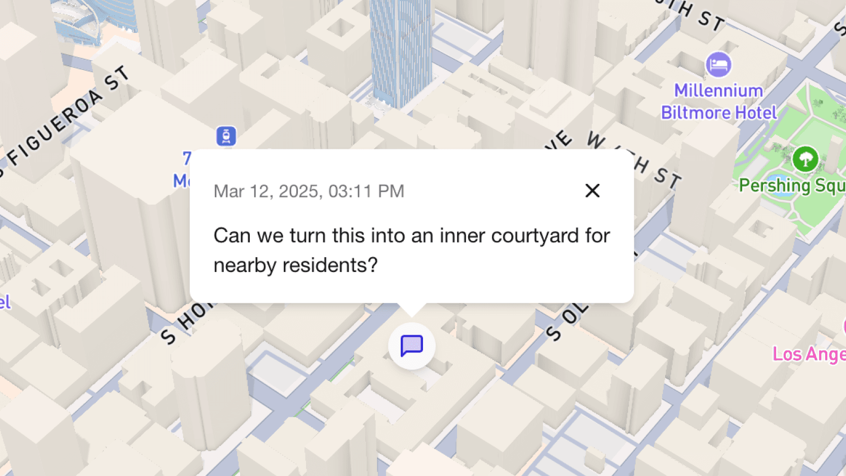
Insite provides interactive map-based tools that enable urban planners to collect location-specific feedback from community members. Our platform combines GIS technology with user-friendly interfaces to streamline public participation in urban design, transit planning, and infrastructure projects. This makes it easier for residents to participate and for planners to gather meaningful, contextual spatial data.
Insite is used by urban planning consultants, transit agencies, local governments, and community development organizations. Our platform supports various projects including transit-oriented development, public space design, zoning changes, and neighborhood improvements. It's particularly valuable for projects requiring extensive public participation and location-based feedback.
Insite offers comprehensive mapping and engagement tools including interactive map markup with custom layer management and public comment systems. Key features include public project publishing with custom URLs, anonymous community feedback collection and multi-language support. Our map interface includes intuitive controls for markup editing, feature labeling, and visibility management. Whether you're collecting feedback on transit routes, managing public space design, or coordinating infrastructure projects, our platform provides the tools you need for effective community engagement.
We implement multiple layers of security: a protected PostgreSQL database with Row Level Security ensuring data isolation, JWT-based authentication, and role-based access control (RBAC). Only authorized users can access project dashboards, and project owners have granular control over public comment visibility. We also employ CSRF protection, input sanitization, encryption at rest, and maintain detailed audit logs for all data access.
We offer flexible monthly and annual subscription plans designed for organizations of all sizes. Our comprehensive support includes implementation guidance, training resources, and technical documentation. ROI is quickly realized through streamlined engagement processes and reduced project delays. Contact us at support@collectiveform.io for detailed pricing information and to discuss your specific needs.